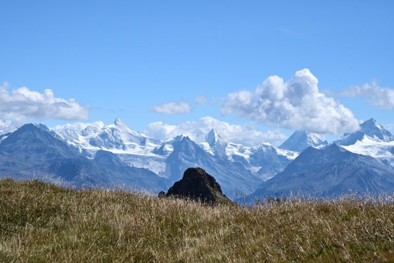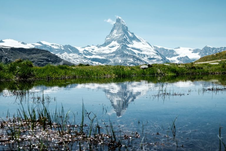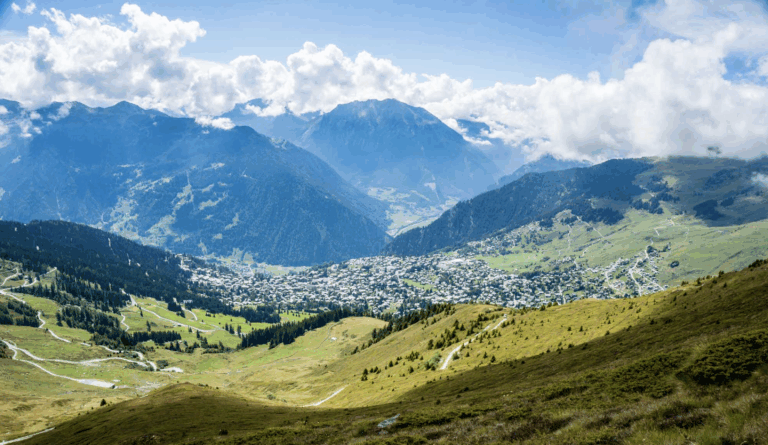
St. Moritz is more than a luxurious winter retreat — it’s also a gateway to some of the most breathtaking summer hikes in the Swiss Alps. Set in the heart of the Upper Engadin at 1,800 meters, the area boasts shimmering lakes, larch forests, glaciers, and panoramic ridgelines. With over 580 km of marked trails, hikers of all skill levels can enjoy dramatic alpine scenery, fresh air, and absolute tranquility.
Here’s a curated guide to the top hiking trails in St. Moritz, complete with all the practical details you need to plan your alpine adventure.
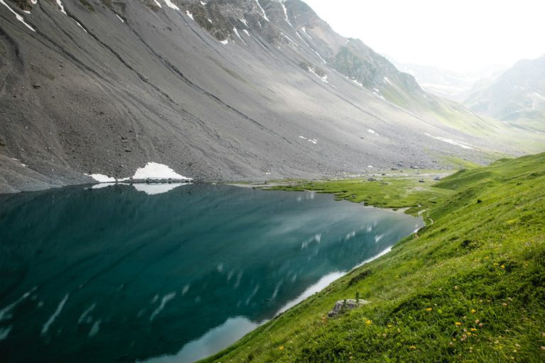
🏞️ 1. Lake Staz (Lej da Staz) Loop
⏱️ Duration: 1.5 hours
📏 Distance: ~5 km
🧭 Difficulty: Easy
⛰️ Elevation gain: ~100 m
📍 Starting point: St. Moritz Bad
Description: A peaceful forest and lakeside walk suitable for all ages. The loop offers reflections of Piz Julier in calm waters and access to a small lakeside restaurant — great for a coffee break or picnic.
⛰️ 2. Muottas Muragl to Alp Languard
⏱️ Duration: 3–4 hours (one way)
📏 Distance: ~9 km
🧭 Difficulty: Moderate
⛰️ Elevation gain: ~550 m
📍 Starting point: Muottas Muragl funicular top station
Description: This panoramic trail along the Segantini Höhenweg delivers jaw-dropping views over the Engadin lakes and Bernina Range. A favorite for photographers and seasoned hikers alike. You can descend via the Pontresina lift.
🐐 3. Morteratsch Glacier Trail
⏱️ Duration: 2 hours (round trip)
📏 Distance: ~6 km
🧭 Difficulty: Easy to moderate
⛰️ Elevation gain: ~150 m
📍 Starting point: Morteratsch railway station
Description: A popular educational trail with signposts marking the glacier’s retreat over the past 150 years. Family-friendly and flat, with rewarding views of the icy Bernina massif.
🌄 4. Lej da Champfèr to Silvaplana
⏱️ Duration: 2 hours
📏 Distance: ~7 km
🧭 Difficulty: Easy
⛰️ Elevation gain: ~120 m
📍 Starting point: Lej da Champfèr shore (via Suvretta or St. Moritz)
Description: This gentle lakeside walk connects two of the Upper Engadin’s most iconic lakes, passing through reed marshes, pine woods, and open meadows. Ideal for a relaxing afternoon stroll.
🏔️ 5. Piz Nair to Fuorcla Suvretta
⏱️ Duration: 4–5 hours
📏 Distance: ~10 km
🧭 Difficulty: Moderate to challenging
⛰️ Elevation gain: ~600 m
📍 Starting point: Piz Nair summit (via cable car)
Description: A high-alpine trail traversing ridgelines and rocky paths with close-up views of the Bernina peaks. Wild and quiet, it’s suited to experienced hikers. Begin high and descend gradually.
🌲 6. Val Roseg Trail
⏱️ Duration: 4 hours (round trip)
📏 Distance: ~12 km
🧭 Difficulty: Moderate
⛰️ Elevation gain: ~250 m
📍 Starting point: Pontresina
Description: A tranquil path along the Roseg River through pine forests, ending at a glacier viewpoint. Horses, carriages, and wildlife are part of the charm. Optional overnight at the Roseg hut.
🌅 7. Suvretta Loop Trail
⏱️ Duration: 2.5–3 hours
📏 Distance: ~6.5 km
🧭 Difficulty: Moderate
⛰️ Elevation gain: ~300 m
📍 Starting point: Suvretta House
Description: A lesser-known gem that loops around alpine pastures with sweeping views of the valley. Expect to encounter more cows than people. Perfect for solitude-seekers.
🌅 8. Mont Gelé Panorama Trail
⏱️ Duration: 2.5 hours
📏 Distance: ~7 km
🧭 Difficulty: Easy to moderate
⛰️ Elevation gain: ~250 m
📍 Starting point: Corviglia funicular station
Description: Hike across meadows and ski slopes transformed into flower-filled terrain in summer. Lej Alv, a glacial lake tucked under peaks, makes an ideal rest stop.
🐾 9. St. Moritz–Celerina–Samedan Trail
⏱️ Duration: 3 hours
📏 Distance: ~9 km
🧭 Difficulty: Easy to moderate
⛰️ Elevation gain: ~200 m
📍 Starting point: St. Moritz village center
Description: A cross-valley route linking three Engadin towns via riverside trails and footbridges. Well signposted, and great for discovering local architecture and landscapes.
🏞️ 10. Hahnensee Trail
⏱️ Duration: 2–3 hours
📏 Distance: ~7 km
🧭 Difficulty: Moderate
⛰️ Elevation gain: ~400 m
📍 Starting point: Signalbahn lift or St. Moritz Bad
Description: Ascend through larch forests to the scenic Hahnensee, where you’ll find panoramic benches and picnic spots. This is a favorite among locals for weekend outings.
🧳 Tips for Hiking in St. Moritz
🌦️ Weather: Mountain weather is changeable — always check the forecast and dress in layers.
🥾 Gear: Trail runners or hiking boots are recommended for rocky sections.
🚡 Lifts: Save energy using the Piz Nair or Muottas Muragl lifts. Summer passes available.
🗺️ Maps: Pick up a local hiking map at the St. Moritz Tourism Office or download from SwissTopo.
💧 Essentials: Carry water, snacks, and sun protection — many trails have few facilities.
Whether you’re walking along glacier-fed rivers or ridgelines above turquoise lakes, hiking in St. Moritz delivers unforgettable scenery and mountain serenity. With trails ranging from gentle lakeside strolls to bold alpine climbs, there’s a route here for every pace and every passion.